|
HOME |
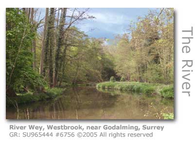
The River Wey Gathering pace the river continues to be fed by numerous small tributaries so that by the time it reaches the old industrial town of Godalming the river was able to support a significant number of mills and tanneries. |
Wey WEY SOCIAL
WEY LIFE WEY FACTUAL
WEY LIFE WEY LIFE
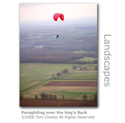
WEY BLOG Where we parked the car you are greeted with a view over the Surrey landscape. After a look at the map kindly posted on a notice board we headed off towards the river and ponds that are there. Kate wouldn't let me take the map off the board for our use on the walk, and I have to sometimes worry about Kate's moral compass. I would have returned it eventually ;) Anyway this was a great wooded walk on a nice spring day. I'll definitely be coming back here with the dogs. Why I've never been here before I don't know, a slip up is all I can say." Blogger Whitespider 1066 19th March 2007 WEY LIFE "We did have some cereals, and at the age of nine or ten my main job was to ride the leading horse of three on the binder at harvest. We grew potatoes and the landgirl gangs provided by the War Agricultural Committee came in to harvest them. In those days you could ask the War Agricultural Committee for a gang of labour to help you gather in crops." Buster Buer, farmer Norney Farm near Eashing. WEY BLOG WEY VILLAINY WEY SQUIRREL WEY CELEBRATIONS WEY CYCLERS WEY GLITTERAZI (1) WEY GLITTERAZI (2) "They are making everyone’s lives a misery," said local resident Richard Morley. "I suppose everyone has a job to do and this is theirs, but they should be more respectful of all the people who have homes and lives here. It has been very difficult getting down the road sometimes because of the sheer number of people there, some of them hiding and some of them just milling around in the road." In keeping with contemporary society's obsession with remaining cold and faceless the announcement of the split was made through Twitter. "Cheryl Cole is separating from her husband Ashley Cole. Cheryl asks the media to respect her privacy during this difficult time. We have no further comment to make." Twitter page of Cheryl’s representatives, Supersonic PR. 23rd February 2010. By August 2010 the red tops had announced that the mansion, which has a separate three bedroomed annexe, was to be sold and was on the market for £3.5 million .The press have suggested but part of the reason was the refusal of planning permission for an underground fitness suite which would have incorporated a swimming pool with a gym and spa. |
|
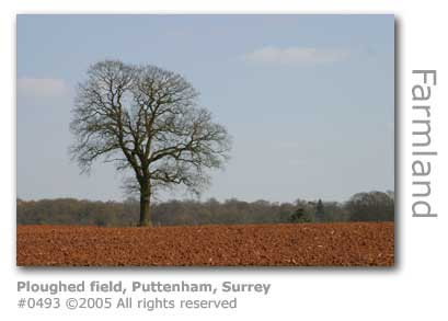
Puttenham
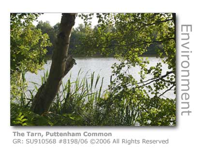
In the wide flat watermeadows downstream from Elstead where the Wey gently meanders on towards Godalming further tributaries flow into the river. The small stream, rising in Seale on the steep slopes of the ancient Hog’s Back chalk ridge in the Surrey Hills and which feeds the sequence of five ponds by Puttenham Common, had milling activity over the centuries. Cut Mill (GR: SU914456) was powered from water held in The Tarn upstream. Given the considerable water management system here it is not surprising that there have been mills operating on the site since ancient times. The common today is the remnant of a once huge area of lowland heath with its ponds providing important wetland and carr wildlife habitats. Substantial archaeological finds here cover virtually every important period, although strangely not yet for the Saxon era. There is a Scheduled Ancient Monument, Hillbury Hill Fort (GR: SU915466), which dates back to the Iron Age but has mostly evidence of a long-term Roman occupation. Hillbury Hill rises to 358ft (109m) above sea level. A large defensive entrenchment consisting of an encircling bank and a ditch, together with a crude pavement and Romano-British pottery was recorded on the common in 1870. The military used the area extensively during WWII for training and there are remains of slit trenches and the butts of a rifle range. An aircraft spotter searchlight is recorded as having been sited where the middle car park is located today.
The first documentation was in a marriage agreement of 1307. By the end of the 16th century the mill by the common formed part of Puttenham Priory (GR: SU933478), a handsome Palladian (1) villa built in 1762 by Thomas Parker with gardens later designed by Gertrude Jekyll, and now fully restored. The Priory has an ice house (GR: SU934477). Roger Taylor, the drummer from the band Queen lives at the house. Another grand mansion in Puttenham is that of Lascombe which was designed by Sir Edwin Lutyens c1900, with the gardens created by Gertrude Jekyll still largely intact. The original coach house, refurbished as a modern home, attracts a monthy rent of £1,350 a month (2007) and is one of four rental properties on the Lascombe Estate which include the old stables. (1) Palladian architecture is based on the work of Andreas Palladio, a 16th century Italian architect who was greatly influenced by the style and proportions of ancient Rome. The six acre Lascombe Walk (GR: SU919470) is managed by the Woodland Trust. The woodland was gifted to the Trust in 1988 having been devastated by the October 1987 storm which severely damaged 90% of the mature oak and sweet chestnut trees. The site was replanted with a mixture of native broadleaves in 1999. The adjoining Puttenham Common is owned by the National Trust. The village of Puttenham, which resides within an Area of Natural Beauty (AONB), has managed to preserve much of its original identity despite its location by the busy Guildford to Farnham A31 that follows the Roman road along the top of the 160 ft (50 m) Hog’s Back chalk ridge. The road here became established as an important route for vehicles once it had been upgraded in 1903 to a metalled surface. The Hog’s Back itself affords some wonderful views of the surrounding countryside to north and south, the name of the ridge alluding to the similarity in shape to the ridgeback of ancient pig breeds although documentary evidence of the name doesn't go beyond William Cobbett's time at the turn of the 18th century.
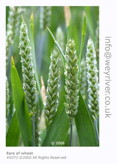
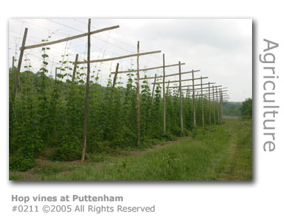
Villagers here were once widely employed in the growing of the renowned Farnham Hops that were in great demand from breweries not just locally but throughout England. Hops are still grown at Duke's Farm along Seale Lane on the lower slopes of the ridge albeit on a much smaller scale.
The same soil, being 6 to 12 inches (15-30cm) of clay loam overlaying a sub-strata of chalk, is perfect for growing vines especially on the south-facing slopes of the Hog's Back. At Greyfriars (GR: SU948484) a small vineyard was established in 1989 by two local vets to produce Chardonnay and Pinot Noir grapes restablishing wine making in the area started by the Romans two thousand years ago.
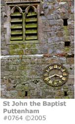
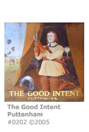
The St John the Baptist Church (GR: SU933478) has Norman arches and window, and its substantial 15th century tower once had a spire, which sadly was destroyed by a fire that had started in the adjacent blacksmith’s forge. The building, of local sandstone rubble and originally with dressings of hard chalk is believed to be of medieval origins, although it was transformed by a restoration overseen in 1861 by celebrated Victorian architect Henry Woodyear (1816-1896) who replaced much of the chalk with Bath stone. A 2007 survey by the church architect revealed significant cracking in the walls of the church tower which resulted in extensive repairs involving the replacement of stonework with measures taken to prevent the spread of damp and improve ventilation. The parish of Puttenham is one of the smaller parishes in the borough with approximately 600 residents (2006). The village’s water supply once came from the well in the churchyard. A painting of Oliver Cromwell, in his campaign tent praying for victory for his Roundheads over Charles I Cavalier army, swings in the wind outside the The Good Intent public house in the centre of Puttenham. The original design was created by one G. E. Mackenney in 1976, who provided designs for a number of pubs around the country. SEE SIGN HERE An historic listed barn in Puttenham has been renovated (March 2007) and converted for use as a camping barn. Located by The Street (GR: SU934479) just off the B3000, the facility provides visitors to the area with a base which is open at weekends from April to October and during the week during July and August. The simple wardened accommodation, which consists of a sleeping area, communal kitchen and shower room, is located on the North Downs Way and the proposed Sustrans Route 22 (2) between Guildford and Farnham at a point not served by Youth Hostels. Booking is essential. The renovation was undertaken by Project Oasis North Downs and made possible by volunteers and support from local and national organisations. MORE HERE Home Farm Barn has been sympathetically restored to be environmentally friendly and utilises rainwater harvesting, solar electricity and solar hot water. This large barn was listed on Rocque's Map of Surrey 1762 and was one of many in the county that were originally built to store corn. With the coming of cheap imported American grain during the 19th century its storage use shifted according to changing agricultural needs and would probably have had various crops including potatoes, mangolds, swedes, oats and hops stored there. The barn is typical of a Surrey barn with its weatherboarding and long steeply sloping tiled roofs known as catslides and waggon porch, and utilised locally available building materials. The roof has 18,000 handmade clay tiles secured to battens by iron nails and wooden pegs. (2) Sustrans is a sustainable transport charity and campaigns to provide a National Cycle Network. Route 22 runs south out of London through Guildford and Farnham and on to Petersfield, Havant and the Isle of Wight. Source: Project Oasis North Downs March 2007 Puttenham Golf Course, which was founded in 1894 by a group of army officers and masters from Charterhouse School in nearby Godalming, is one of the oldest clubs in Surrey. The land the founders wanted to use was owned by the Lord of Puttenham Manor, Mark Smallpiece, who was persuaded to lease the land on Puttenham Heath (GR: SU942476) by one of Queen Victoria's top military leaders, General Sir Frederick Marshall, who became the club's first president. The queen had reputedly visited Puttenham when in 1858 she took the salute of 20,000 soldiers that had amassed on Frowsbury Hill for a Royal Field Day. Frowsbury Hill is the site of the club's second tee and is the location of an ancient tumulus with significant numbers of Neolithic flints having been found nearby. The club had been restricted to nine holes until 1990, but after the freehold to the club was negotiated from the Smallpiece family in 1981 and the 44 acre Monk Grove Copse was purchased, the couse was extended to a full 18 holes. Queen Victoria's great, great, great grandson The Earl of Wessex was the guest of honour (July 2008) at Puttenham Golf Club on the 150-year anniversary of the queen's visit. Prince Edward, acompanied by the Queen's own Ghurka Regimental Marching Band and the Godalming Band, unveiled the club's renovated memorial site on Frowsbury Hill. Cutt Mill House in Puttenham rests alongside the 5.3 acre Cutt Mill lake which once served the mill. The oldest part of the brick and stone house dates back to the 15th century and the property with its six bedrooms and four bathrooms was on the market in July 2009 for £3.5 million. As well as boasting a large mature garden, the house has access to the lake with a boathouse and the stew pond, in which monks from Puttenham Priory used to keep their carp which they traditionally ate on Fridays, and also has use of a garden cottage, a stable block, and an array of former farm buildings. Alongside the lake is a mill race with a 12 foot (3.66m) waterfall, and the lake is stocked with a variety of coarse fish including pike, tench, carp, roach, rudd and perch. Two miles (3km) or so due west from Puttenham and closer to Farnham is the village of Seale with its picturesque church. The combined population of the village with neighbouring Sands was 900 in 2007. The village has a community hall, nursery school and a football ground. The Manor Farm Craft Centre by the church was founded in 1980 and is housed in old farm buildings. An independent parish survey conducted in 2007 revealed that 44% of residents in the village responding to the questionnaire were retired and 20% had one or more children under the age of 8 years. The Church of England primary school in Seale closed in 1999 at which time the church established a Religious Education Fund 'to make provision within Seale, Puttenham & Wanborough for religious education in accordance with the tenets of the Church of England by means of Sunday School or otherwise'. In 2005 the fund stood at £15,000.
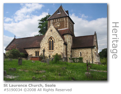
St Laurence Church (GR: SU897479), with part of the Grade II Listed building dating back to Norman times, was almost entirely rebuilt 'in Picturesque' style in 1861-73 and has seating capacity for 180 people. The font has been dated as 12th century as have the main door and that leading into the vestry from the sanctuary. A painting above the altar is believed to be 15th century and from the School of Cima de Conegliano, a Venetian painter (1459-1517). The bell tower, above which rests a pyramidal spire, houses a peal of six bells with the oldest and largest having been forged in the 16th century The church architect for the Church of England conducts five-yearly inspections, with the 2007 inspection identifying the need for repairs to the tower, clock faces and weather vane. The Friends of St Laurence hope to be able to raise the necessary finance from their fundraising efforts. Attendances at services at the church were reported by the Parochial Church Council (PCC) as having risen by 8% in 2007 compared to the previous year, although no worshipper numbers were stated. The combined attendances of all four churches in the parish (including Sands, Puttenham and Wanborough) was 6,853 for the year. At the end of 2007 the PCC reported unrestricted financial reserves (1) of £38,570 available for the general upkeep of the church, although the cost of maintenance within the four-church parish was exceeding regular income raising concerns that funds would be exhausted within four years. (1) The church has unrestricted reserves which can be used for any purpose. Other restricted funds are available but are limited on their application by the purposes stipulated in their bequests. Nearby is the family-owned and run Hampton Estate (GR: SU907467) off the Elstead Road with Hampton Lodge, a Grade II Listed Georgian house at its heart and set in rolling parkland laid out by Humphrey Repton (1752 - 1818), a renowned landscape designer of the time. The estate was established by Thomas Parker during 1759 - 1766 who combined land acquisitions to create a substantial property, and for which he retained a local name that has appeared on manorial rolls since 1268. The Thornton family have owned the estate since 1929 with Bridget Biddell (nee Thornton) and her husband now managing the estate (2008). Hampton is an agricultural estate with farming and forestry accounting for most of its 2,250 acres. The farm produces wheat, barley and rape, as well as market gardening specialising in baby leaf salad vegetables and the last commercially run hop garden in the county. Some of the estate housing is let as residential property. The hops operation covers 14 acres in Puttenham (GR: SU925479) and produces 'Fuggles' hops used by brewers including Harveys (Lewes, Sussex), Adnams (Suffolk) and locally Hogs Back Brewery in Tongham. throughout the country, and also decorative hop garlands during the hop picking season from August to September. Many of the hop plants are over 20 years old. The Hampton hops were judged National Champion Hops in 2003. The farm also manages a pedigree herd of Sussex Cattle and has a farm shop on-site. Products from their forestry management include chestnut fencing posts, firewood, logs and woodchip. Educational visits by schools and farm walks during Surrey Farming and Village Week are organised by the estate. The Tarn and The Warren waters (GR: SU 909458) on the estate are leased to the Farnham Angling Society for carp fishing. Hampton has also supported the Permissive Access Scheme in partnership with the Forestrt Commission opening up footpaths through the estate. The North Downs Way long distance footpath also winds through the estate. Hampton Estate was shortlisted for the 2011 Toast of Surrey Business Awards.
Hampton Estate is used by production companies as a film location, with recent filming undertaken there for the ITV series Midsomer Murders starring John Nettles (February 2008) and an Agatha Christie's Poirot episode The Hollow by LWT starring David Suchet and Edward Fox (2004). Over a period of over 12 months (2008/2009) Hampton Estate was converted into the setting for Nottingham Village to be featured in Ridley Scott's adaptation of Robin Hood. This location was to become the most important site in the film and was the place where Robin (Russell Crowe) comes to return Sir Loxley's sword to his father. The set was designed by Oscar winning production designer Arthur Max and was set amongst ancient oaks and rolling fields, which together with a pine forest, a stream and the book provided a wide variety of shooting options. The reconstruction of Nottingham provided buildings around the town square, with a grain store, a tavern, a tithe barn and the church, as well as houses and hovels of all shapes and sizes stretching out beyond the town centre.
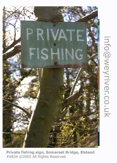
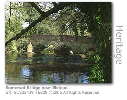
SEE ALSO: ROBIN HOOD AT PEPER HAROW Medieval Bridges - Elstead to Eashing Having made a broad sweep northwards up away from Elstead the river passes beneath Somerset Bridge (GR: SU922439) on its way towards Peperharrow. This is thought to be one of the original medieval bridges built by the Waverley Abbey monks although following centuries of repairs, many quite extensive after flood damage, it is now much altered and tiered with strengthening S-irons. A brick parapet was added in the 19th century. Prior to the monks’ bridge there was only a ford here documented as 'Sumaeres Forda' or ‘Somersford’ referring to a local family name of Somer.
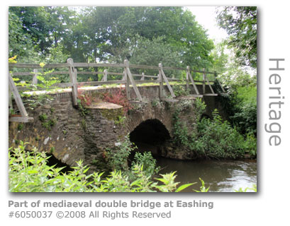
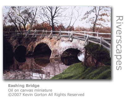
Just upstream of Somerset Bridge the river is quite deep and is favoured as a swimming spot by locals. There is a substantial medieval stone double bridge (GR: SU946438) at Eashing, again part of the Waverley Abbey series of constructions. Now cared for by the National Trust both bridges were repaired and then gifted to the Trust by The Old Guildford Society in 1901. The bridges are now protected by Scheduled Ancient Monument status. A sign erected by the National trust at the bridges reads:
The stretch of river by the eastern-most bridge is a popular site for local swimmers (GR: SU947438). A small and highly unusual split-larch chapel that had been built near Eashing bridge in 1857 was dismantled and rebuilt in 1996 at the Rural Life Centre in Tilford to preserve it for prosperity. Eashing Chapel had originally been ertected as a twenty-seat place of worship for a small group of Eashing parishioners who had become alienated from the established church by what they described as 'ritualistic practices'. The prefabricated building was erected on land on the western side of the bridge donated by the owner of Eashing Mill, Samuel Pewtress. Evening services were first held in the new Congregational Church (1) the following year and a Sunday School was established there with 40 children and five teachers. By 1909 the chapel had become largely redundant following the death of the original lay preacher and a conflict with the established church, although the Church of England was on record until the late 1940s as maintaining it as a chapel of rest. Having finally become redundant as a place of worship in 1950 the building was purloined by a local smallholder who literally uplifted the building and wheeled it across Easing Bridge to a new site beneath a steep sand bank opposite Pewtress Cottages, where as a log shed and chicken coop it was allowed to gradually deteriorate. Surrey Historic Buildings came to the rescue by providing a grant for restoration, and having commissioned architectural drawings dismantled the building and shipped it to the Rural Life Centre in 1994. The building lacked one wall and a third of its roof was beyond saving. The original external cladding of split larch poles, which gave the building its very unusual appearance, had to be completely replaced. A local hurdle maker provided cleaved chestnut as a durable alternative, although one of the original wall panels was retained to show how the original building had looked. A decision was made not to replace the unusual covering of distempered hessian that had been stretched over the timber frame on the interior for fear of damaging visitors' clothes. The chapel, which was restored in 1996, has been furnished with pews, lecturn and a working harmonium from a Baptist chapel in Farnborough as the original furniture had long disappeared. (1) The Congregational Church originated in the 16th century as a non-conformist body and became very popular during the English civil war.) Eashing Mill (GR: SU946438) in an 1830 sketch the mill is shown as a paper mill complete with a louvered drying loft and rag house. There was also a corn mill sharing the site. The mill was completely rebuilt two years later to incorporate contemporary paper milling machinery, and again in 1852 having been destroyed by fire at which time it had 15 beating engines powered by two waterwheels and a steam engine. The considerable amount of paper it produced, which included continuous rolls, were used for printing The Times and other papers. The mill finally closed in 1899 having been defeated by the huge new modern mills closer to the coast. A flock mill opened here in the 20th century but had to be rebuilt, now only as a two-storey building, after a fire in 1960.
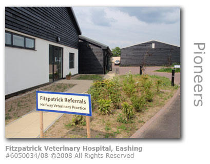
The buildings continued to be used for industry but in 1998 were renovated for housing with the land being used for a business park. There had however been mills on this site since before the Domesday Survey in 1086 with usage over the centuries including corn and fulling. There was a short-lived royal Saxon fort at Eashing which was not far from Peper Harow. World-leading Veterinary Hospital Europe’s most advanced neuro-orthopaedic centre for domestic pets has been opened (August 2008) at Eashing. Noel Fitzpatrick, a leading pioneer of prosthetic implants for animals, chose the location utilising disused farm buildings on Halfway Lane to build a state-of-the-art veterinary hospital for cats and dogs.
Operating as Fitzpatrick Referrals the new £10m facility builds on the experience of Fitzpatrick who was the first veterinary surgeon to successfully apply a prosthetic limb to a dog where both bone and skin can grow on to metal. The medical profession have lauded his pioneering work which can provide a cross-over into human medicine to provide solutions for conditions that may not previously have been operable.
The practice is the only veterinary hospital in Europe to install a closed-field MRI scanner which provides high quality images of bone, spine, brain and soft tissue enabling diagnosis of a wide range of conditions from slipped discs to tumours. The hospital also boasts a physiotherapy centre and hydrotherapy pool. The official opening of the centre saw over 500 vets and specialists from all across the British Isles attend an event which was compered by radio DJ Chris Evans, whose own German Shepherd Enzo was returned to full health by Fitzpatrick having suffered paralysis from two herniated discs, with live music provided by Irish band The Saw Doctors.
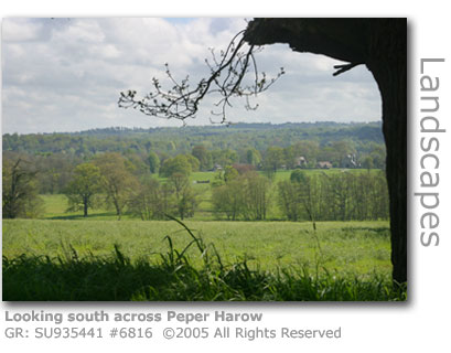
Source: The seemingly oddly named hamlet of Peper Harow (GR: SU935441) near Godalming is as distinctive for the debate over its unusual spelling as it is for its history.
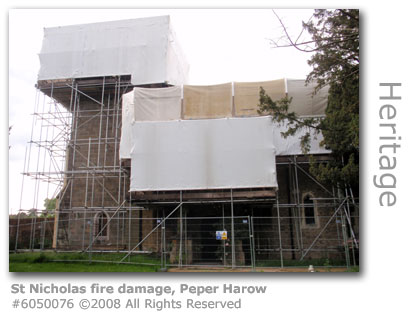
Attempts at making 'piper's temple' stick as a translation from Old English with a suggestion linking to a mystical musician fail through a lack of evidence, although 'piper's hearg' with hearg designating a locally important temple does suggest some association with an important religious site of some sort. It is more likely that 'Piper' was a family name (Pippa and Pipard being variations) with evidence of the name recorded amongst those families who fought the Normans at the Battle of Hastings in 1066. So this would make 'pipers hearg' the 'temple of the family Piper'. Some sources suggest there was a significant pagan temple somewhere in the upper Wey valley some 1,500 years ago. No archaelogical evidence has been unearthed of a temple within or near the church at Peper Harow, although the archaelogical finds of ramparts of a temporary fortress on a promontary a mile away near Eashing suggest the area was of importance. A 9th century manuscript Burghal Hidage (1) mentions the fortress, although later versions with the fortress omitted suggest the fortress was resited to the strategically more important Guildford. It is interesting to see the evolution of the spelling from Pipere-herge (1086 Domesday Book) through Piperhearge (11th c); Piperinges (13th c); Pyperhage (14th c); Pepper Harrow (16th c to 18th c) and to Peperharo (1610). At the time that the Bishop of Winchester had provided a grant to establish the first Cisterian order at nearby Waverley Abbey (1128) a small church, St Nicholas, was established at Peper Harow. The site has provided a parish church since before 1301 Little remains today of the original building which is now constructed of local stone rubble with Caen stone dressing. The modern church has an 1826 tower and houses three 17th century bells. The Victorian architect Augustus Pugin (1803 - 1853) undertook a redesign in the 1840s completely changing the look of the building by introducing a series of different medieval English church styles throughout. The church boasts a substantial lych gate and coffin rest which was erected in 1893. The inscription above the gate reads:
There is an ancient yew tree in the churchyard which has been dated to over 600 years old. The historian Dr Owen Manning (1721 - 1801), who was the original author of The History and Antiquities of The County of Surrey, was rector at St Nicholas. His book, which was unfinished at the time of his death, was completed by William Bray and published in 1814. Sir Henry Dalrymple White, who led the charge of the Heavy Brigade at the Battle of Balaclava (1854), is buried in the churchyard. In 1995 local residents formed the Churches Heritage Trust to ensure the upkeep of St Nicholas and St Mary's in nearby Shackleford. A severe fire broke out in the church just after midnight on Christmas Day 2007 which took 50 firefighters over an hour to bring under control. The brunt of the damage has been borne by the tower, parts of which date back to Norman times, and the 19th century roof of the nave which has been completely destroyed. The church's organ also perished in the blaze and the interior of the church is severely damaged. The damage would have been considerably worse if the efforts of the firefighters had not kept the flames from reaching the east end of the church and its altar. The font and pulpit survived the blaze, as did the larger stained glass windows. The vicar, the Rev John Fellows, is confident that the church will eventually be restored as the building was fully insured. Initial investigations suggest that the cause of the fire was an electrical fault.
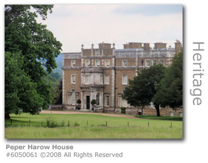
The estate has had 40 documented owners since the 11th century many of whom were highly influential figures of their time. The longest ownership was of the Brodrick family who took over the estate in 1712 and over the ensuing two hundred years developed the estate to what can be seen today. This included the 1765 building of Peper Harow House by the renowned architect Sir William Chambers (1722 – 1796), much favoured by King George III. Capability Brown landscaped the 19 acre estate in 1762-3 and many of the fine trees he planted remain today. Number 6, Peper Harow House, one of two flats occupying the top floor of the Palladian mansion was on the market for £1m (August 2009). The accommodation includes three bedrooms with en-suite, a roof terrace and garage and car port. After the last landed owner Earl Midleton died in 1942 the family broke the estate up into several farms, and property in the outlying villages of Shackleford and Eashing were auctioned in 1944. Somerset Farm alongside the bridge of the same name near Elstead was sold to the resident tenant farmer. The Canadian Army were headquartered at Peper Harow House during the Second World War with several fortified gun emplacements still in evidence along the riverbanks nearby. A charity The Peper Harow Foundation, today known as Childhood First, evolved from an approved school on the estate in the 1970s to provide a therapeutic community for traumatised children and young adults. Inspired by the life-work of the unorthodox educationalist George Lyward (1894-1973) the foundation, which was formed by Melvyn Rose at Peper Harow in 1970, provided education in a therapeutic environment for teenagers who had suffered abuse. Rose wrote an assessment of his work at Peper Harow in his book Transforming Hate to Love (Routledge 1997 ISBN: 9780415138314) in which he describes how through managing rather than punishing disruptive behaviours adolescents could be helped to regain a normal life instead of being consigned to the state's approved school system. The charity was based here for over 20 years but no longer operates on the estate.
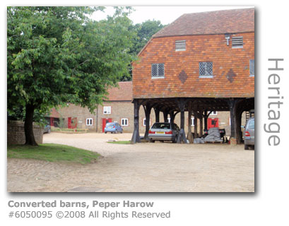
Today Peper Harow is a private estate with domestic residences for over 30 families. Peper Harow Business Park consists of 10 office suites spread across four converted barns, the Old Dairy and the Smithy. Although the estate is not a public thoroughfare a public bridleway runs through the estate from Lower Eashing (GR: SU943441) to the Shackleford Road by Dark Dale (GR: SU929444). It resides in a Conservation Area and is classified as an Area of Outstanding Natural Beauty. Some crop and livestock farming continues at Home Farm. Documented records show that cricket has been played at Peper Harow since at least 1727. The estate maintains its own cricket pitch and team to this day. When the estate was sold off for individual residential plots in 1995 a pair of 19th century ornate gilded wrought-iron gates were removed. Luckily these were recovered from a local architectural salvage yard and following refurbishment the Tulip Gates were reinstated. Peper Harow became a film set (2008/09) for scenes shot in a remake of Robin Hood starring Russell Crowe and Cate Blanchett. A Nottinghamshire style village was reconstructed in the grounds.
Robin Hood classified as 12A and running at two hours and 21 minutes was released in May 2010. It was directed by Ridley Scott. The following review of reviews was published in The Week magazine:
SEE ALSO: ROBIN HOOD AT HAMPTON ESTATE SEALE (1) Saxon records were kept of important fortified 'burhs' or towns. King Alfred commissioned the Burghal Hidage a series of which were produced (878-9) to record the defence capability of his Wessex Kingdom, within which this part of the Wey Valley fell. There is reference to a fortress at Burpham (today absorbed into Guildford). Each burh is assessed in hides, a measurement of arable land which in 'hidage' relates to the size of the garrison and the length of defences. Burpham had a hidage of 720 putting it in a middle-ranked position of Alfred's 33 burhs in his Wessex kingdom.
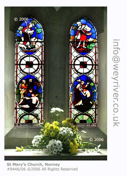
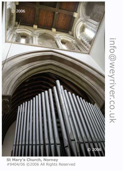
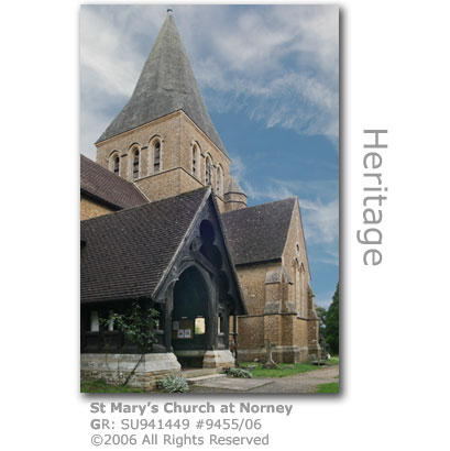
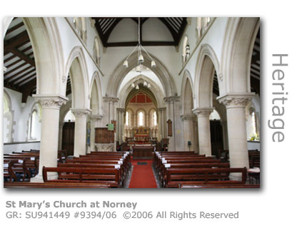
The large Grade II listed church at the Norney crossroads on the Godalming to Peper Harow road is considered to be among the best designed churches in Surrey. St Mary's (GR: SU941449) was designed by the renowned architect Sir George Gilbert Scott in 1865. Built from local Bargate stone it is a wonderful example of Victorian interpretation of the Early English style. St Mary's is the Parish Church for Shackleford and Peper Harow.
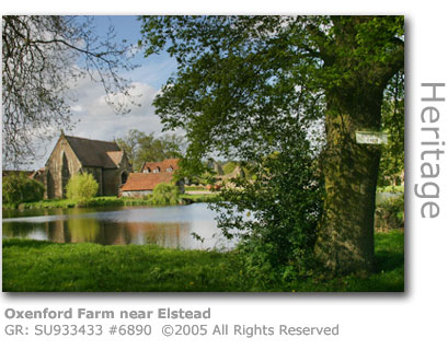
Two Farms of Note The distinctive buildings of Oxenford Grange (GR: SU933433) can be seen from the Elstead to Milford Road (B3001) and often stimulate comment as to their history.
Still employing traditional farming methods today the farm can trace its origins back to it being recorded as a Ley farm for Waverley Abbey in the 12th century. The present owners have farmed at Oxenford since the 1880s. Over the centuries Oxenford passed through many hands until Lord Holles amalgamated the property with Peper Harow in 1676. He sold the estate in 1713 to the first of a long line of Viscount Midleton's, Alan Brodrick, whose family had made a substantial fortune in Ireland. Brodrick was created 1st Viscount Midleton, named after a town on his Cork estate in Ireland, and his family were to own Oxenford and Peper Harow well into the mid 20th century. In 1747 the 3rd Viscount demolished the house at Peper Harow and whilst a replacement was being built his family moved into Oxenford Grange. The dominant buildings visible from the road are relatively modern having been commissioned in 1843 by Lord Midleton, the 5th Viscount, for design by English architect Augustus Pugin (1812 - 1852) who was renowned for his neo-Gothic inspired creations. They once sat astride the principal entrance to the Peper Harow estate with the most striking being the Gothic styled 'Tythe' barn that stands by the carp pond, the latter having been created as part of the original 12th century Ley farm.
The result was a group of buildings generally agreed to be among Pugin's finest work and which were built from local materials in a Picturesque style. The Oxenford Gatehouse was signed up to the Landmark Trust (2009) (1) and provided with a complete renovation to safeguard its future and is now (2010) available as short-stay accommodation.
The property has attracted attention from the media including this piece from a Sunday newspaper:
Guests can expect to pay £700 plus for a three night stay (2010) providing accommodation for four people. (1) The Landmark Trust was founded in 1965 to rescue historic and architectural league interesting buildings and their surroundings and provide them with a new life following restoration by letting them as 'places to experience' for shortstay holidays. Oxenford's long history provided Lord Midleton with material to also build the mock 'ruin' that stands beside today's farmhouse. Stone from the remnants buildings at Oxenford pulled down by the 4th Viscount Midleton were used to construct the folly. The farm was chosen to serve as a location for the filming of the latest Robin Hood remake in which the Sheriff of Nottingham is controversially made out to be one of the good guys. Merry Men Films Ltd transformed the farm in early 2009 to look like homes that would have been inhabited during the 12th-century, and it is believed that one of the buildings is to feature as the home of Maid Marian in Sir Ridley Scott’s £110m epic version of Robin Hood. Filming started in April 2009 with the Australian Russell Crowe as Robin Hood, Cate Blanchett as Maid Marian and Vanessa Redgrave as Richard the Lionheart’s mother Queen Eleanor. Additional scenes were shot in a glade of ancient oaks in the heart of Hampton Estate in nearby Elstead, the woods serving as a useful stand-in for Sherwood Forest. The Hampton Estate also provided the set for scenes filmed for the Christmas special of ITV1’s Midsomer Murders. Blogging fans have also reported set-building of a fortress in Lower Bourne woods. The Surrey Advertiser reported that the Robin Hood stars have been regularly sighted around the area. It would appear that Crowe is especially fond of curries as he has visited the Mogul Indian Restaurant in Bagshot at least four times to satisfy his craving.
The production has had more than its fair share of problems. Reportedly the producers had to delay shooting from last year (2008) as they apparently considered Crowe to be too overweight, and Sienna Miller who had originally been cast as Maid Marian withdrew from the production. Gossip columns have also reported multiple rewritings of the script supposedly to give Crowe greater stature and the fact that the original schedule was running so late that the leaves of ‘Sherwood Forest’ would have fallen from the trees by the time filming had finished. The press reported that Crowe eventually shed four stone (25kg) before filming started this year. Robin Hood opened in the UK in May 2010. SEE ALSO: ROBIN HOOD AT PEPER HAROW A little further north is Lydling Farm (GR: SU931462) located just outside Shackleford. A significant producer of beef and pork Lydling has a long history of farming. Neolithic flint implements have been found here together with a Romano-British Cinerary (a cremation urn) and the farm was part of the Rodsall in Godalming Hundred owned by the Saxon Tovi. By 1086 it was recorded in the Domesday Book as being owned by the Bishop of Bayeux. The first detailed records of the farm date back to a deed of sale in 1711 when one Richard Ford bought it for £1,600 whence it remained within the Ford family for a hundred years. Field names recorded in the deeds provide a fascinating window into Lydling's past. Kiln Field was where chalk was burnt to produce lime to spread on the fields. Bar Field reflects the time whens when 'bars' and 'chains' were used to provide linear measurement. Others such as Whirl Hill, Stony Windsor, Brummells and Hornes hint at long-lost local connections. Neighbouring Cross Farm was owned in 1700 by Richard Wyatt, who built the alms houses in Godalming (see here), and it is he that had sold Lydling to Ford. The Stovolds, one of Surrey's oldest farming families with records of association with agriculture dating back to 1367, managed the farm in 1874 and bought it in 1934. Today the farm is run by its 5th generation of the family who breed and keep Aberdeen Angus cattle and British Saddleback pigs. The farm actively supports conservation to preserve the local ecology with proactive maintenance of hedgerow wildlife habitats, 18ft (6m) margins around all fields to provide wildlife corridors, and the use of farmyard manure instead of chemical fertilisers. Crops are rotated, thistles are encouraged to provide winter feed for birds and bird and bat boxes have been erected to increase the number of species living on the farm. Shackleford - The Mushroom Wars Shackleford Mushroom Farm survived in a climate of rising costs and aggressive competition from abroad until, as one of the last specialist producer of mushrooms in the south-east of England, it closed in 2008. The farm, which had operated for 50 years employed 80 people. Surrey Food Links, an organisation that promotes local produce, said it showed how dominant supermarkets are in the buying process.
The 2.83 hectare (7 acre) site has been identified as a major green belt development site and is now owned by Wates Developments, a leading UK land management group. The company held a public consultation in Shackleford village hall in December 2007 to discuss its preliminary proposals for the site which were to build 12 new homes of which four would provide affordable housing. A second public consultation was held in May 2008 to air the plans for a revised proposal of 18 new homes and additional affordable housing. However in April 2009 the firm submitted a detailed planning application which provides for 25 houses, nine affordable homes and two houses for key workers. Wates Developments planning statement described the farm as having ‘the appearance of an intensely developed industrial site’ and stated:
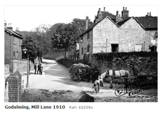
Villagers are concerned that they may lose their children’s playground, cricket club and the Cyder House Field all of which are part of the farm site. The development company has stated that it intends to secure the long-term future of the cricket club enhancing the cricket pavilion and the children’s playground, the latter which it intends to transfer to Shackleford Parish Council. It has also stated that it has no plans for Cyder House Field which is currently being used by a local farmer. Sources: The developers withdrew their plans after triggering 42 objections and have submitted (October 2009) scaled down plans for 18 homes including seven affordable houses. Aldro as an independent boys' boarding school, situated in part on the site of an Italian POW camp in Shackleford, was founded in the 19th century and until the 1970s followed a military-style discipline. The more relaxed modern school achieved great popularity under the headmastershp of Crispin Hill who after his retirement founded the unique Skillway Charity in Godalming that provides vocational help for young people struggling in mainstream education. The school which is located in Lombard Street, Shackleford originated from a small preparatory school in Eastbourne which was founded in 1877. The institution, which became St Andrews School, was taken over in 1890 by clergyman Edwin Leece Brown who was fondly referred to as 'ELB'. ELB, whose portrait hangs proudly over the fireplace in the drawing room of the modern school, instructed his brother Harold to start up a boarding school in an annexe which he decided to call 'Aldro' using the name of a farm in Yorkshire that he visited regularly. The farm was named after an old English term meaning an alder row, or row of alder trees. Aldro opened in Eastbourne with 36 boys paying 100 guineas a year in school fees. The school went from strength to strength and by the time the Rev Harold Browne died after a short illness in 1922 it attracted boarders from all over the country. The new owners Frederick and Audrey Hill developed a philosophy for the school based on military life. The individual school houses were called 'squads' with the boys undertaking military drill each day, and each of the squads were named after the countries of the Empire. This military-style regime survived until 1978. With the start of the Second World War the threat of invasion and bombing raids along the south coast resulted in the school being evacuated to Hall Place in Shackleford. The mansion was purchased from the estate of Sir Edgar Horne after his death in 1941 for £10,000. The boys moved into their new home the following year and were immediately absorbed into the realities of wartime civilian life. The school's playing fields were ploughed for hay production and the boys regularly helped on local farms working alongside the Italian POWs from a camp located where Rose Cottage once stood. Twenty old Aldronians lost their lives in the war, and the barn was converted into the War Memorial Chapel in 1949 to commemorate their lives. After the death of Frederik in 1952 his elder son Crispin Hill took over as headmaster and the school continued to grow providing for the education of 140 boys by the time he retired in 1984. The school added a pre-prep department in the old Italian POW camp buildings in 1954, although this was eventually closed nine years later with the land being sold for development. Crispin Hill was an inspirational teacher who also took a practical approach to special needs teaching, and after his retirement he helped establish the Skillway charity (MORE HERE) in Godalming to help young people who experience problems in mainstream education. A multipurpose hall was named after Crispin Hill in 1987. The school today is run by David and Sue Aston who took over in 2001 and who have continued to develop the school as it enters its second century. Aldro has 220 pupils between the ages of seven and 13 (2010) with 65 full-time boarders housed in 10 dormitories. The school is administered by an educational trust and has the Christian foundation at its heart. Aldro also has close links with the Christian Titus Trust with boys enjoying their activity holidays. The school boasts extensive facilities including a new classroom block opened in 1999 as the Centenary Building complete with a well-equipped ICT suite and library. There is also a purpose-built theatre and an indoor sports hall in the Crispin Hill Centre, which also houses a music school. Sports activities embrace all of the main disciplines with the boys having access to facilities including an outdoor heated pool, tennis and squash courts, a rifle and pistol range, a nine hole golf course and the school's own lake on which boys enjoy rowing and fishing. The IAPS National Chess Championships have been held at Aldro for a number of years, with many of the boys enjoying success in national competitions and several representing their country. The school gardener discovered a dead seabird in the grounds (December 2009) which was identified as a rare Leach's petrel (Oceanodroma leucorhoa) by a researcher at Plymouth University. It is likely that the bird was carried by recent storms away from its normal habitat in the northern Scottish islands and eventually died of exhaustion. Sources: Downstream from the Eashing bridges the river heads north-east before making a right hand turn to flow down into Godalming. Along this north bearing the Wey reaches a Site of Special Scientific Interest (SSSI) (GR: SU950444) which has been protected to preserve a series of wetland habitats including damp grassland, fen and alder swamp, and an ancient semi-natural woodland. A tributary to the Wey, the River Ock which rises near Hambledon a few miles south of Godalming, has its confluence with the Wey near the railway bridge which brought the new line over the river and into Godalming in 1849. Close to here is the parish church with its proud spire clearly visible as a landmark from miles around. In the aptly named Mill Lane near the centre of town are a number of old black and white timber houses that were built around the mill.
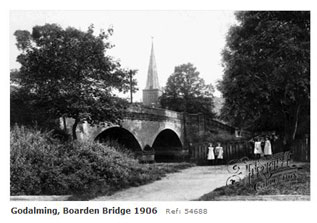
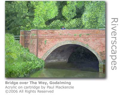
The road bridge crossing the river near the church at Godalming is Borough Bridge (GR: SU967442) which took over from the smaller wooden Boarden Bridge that lies alongside and that could carry little more than a man and a small horse. Before the wooden bridge, which is named after 'board' as the word used in Norman times for 'wood' hinting perhaps at how long a bridge has been present here, there was a ford here which provided the main link to Guildford. In the eighteenth century the bridge would have led into the fields of Deanery Farm Estate which dominated this extremity of the town, with the track passing over a series of smaller 'Little Pray Bridges'. These were built over smaller streams and culverts including Hell Ditch which feeds into the river via the Lammas Lands. The farmhouse still stands today as a private residence next to the Scout Hut on Charterhouse Road, which itself is housed in the old farm buildings. The brick bridge was built in 1870 by the local authority to link the town with the newly relocated Charterhouse School (MORE HERE) which they recognised would become an important employer and generate considerable business for the town. Charterhouse was built on 68 acres of land purchased from Deanery Farm. The bridge became known locally as the ‘Lunatic Bridge’ because the borough council in its infinite wisdom designed it with large arches high enough to allow boats to pass through, a complete waste of taxpayers money because the river was far too shallow for anything larger than a punt to navigate, and even that would risk grounding. The Godalming Navigation built in the previous century terminates half a mile downstream and there were never any plans to extend it further. Upstream of here, where the river skirts close to the end of Peperharow Road (GR: SU957446), is where teachers from the newly built Charterhouse School in the 19th century used to supervise swimming by their young charges.
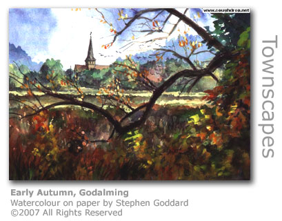
Immediately downstream on the south bank of the river is the parish church which was built to replace the old one built by the Saxons in nearby Tuesley. St Peter & St Paul’s (GR: SU968440) has had work adding to its impressive buildings in the thousand years from the 9th until the 19th centuries, with the tall spire having been added in the 14th century. There is a parish chest dating back to 1200 in safekeeping at the church and medieval paintings have been uncovered on some of the walls. MORE ON THE CHURCH OF ST PETER & ST PAUL The church and its graveyard has a commanding position overlooking the river and the common water meadows on the far bank which are an extension to the Lammas Lands further downstream. Right next door the Phillips Memorial Recreation Ground was built in 1914 to honour the loss of one of nearby Farncombe’s heroic sons, Jack Phillips the wireless operator who went down with the Titanic whilst trying to raise help. An Industrious Town
There were numerous watermills and tanneries in and around Godalming. Add to that woollen factories, quarries, and breweries so that by the end of the 19th century the town would have been a very industrious if not noisy and pungent place in which to live.
At the turn of the 20th century the huge chimney of Rea & Fisher’s oak bark leather tannery dominated the town, not just with its sheer bulk but also the persistent and pungent smell emitted by its industry. Other smaller chimneys pinpointed business concerns allied to the clothing industry for which Godalming was renowned. Nearby would have been Allen Solly’s steam hosiery factory.
Three large tanneries worked in close proximity in and around the Wey and its tributary the Ock near the centre of the town. The tannery at Westbrook Mill (GR: SU966442) on the River Wey specialised in the soft chamois leathers, another in Ockford road near the mill there produced small skin leather including rabbit and the larger hides were treated at Rea & Fisher’s. A clutch of slaughterhouses serviced the tanneries. When Westbrook closed the tannery in 1913 its extensive complex of buildings continued to be used by businesses using the Wey for power. The factory was finally demolished in 1980 and there is little left today to give any indication as to its historic importance to the town despite its long history. Corn and paper milling, leather dressing and fulling had all been carried out here, with reference to fulling and leather mills operating side by side in 1788.
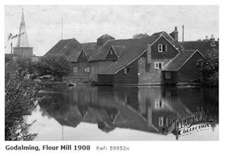
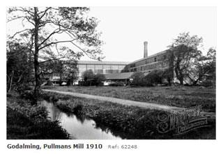
The town finally lost its last living link with the clothing industry when the clothing factory of Alan Paine closed at the end of the 20th century. Milling for various industries has been conducted along this part of the Wey Valley for over a thousand years, with three mentioned in the Domesday Book. The oldest site of a mill is at Westbrook, which has also been known as Salgasson and Pullman’s, and it is likely that this was grinding flour at the outset. Ockford Mill (GR: SU962433) as the name suggests straddles the Wey’s tributary the Ock behind a large millpond next to the Inn on the Lake. Long since converted to offices, the mill’s first occupant was a corn miller in 1835 who took power from a waterwheel and eventually from a Little Giant water turbine that was installed in 1886. The miller’s house was on the opposite side of the Portsmouth Road at what is now called Headley Lodge. All the machinery was removed when the mill closed in 1934 and the renovations have left the building looking little like a mill now.
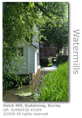
Hatch Mill (GR: SU966438) also on the Ock in Mill Lane dates back to the 17th century and was still operating as a flour mill in the early 20th century. However it is very likely that a mill on the site here was one of the three in the area mentioned in the Domesday Survey. In 1940 a more efficient water turbine was installed, and this Gilbert Gilkes & Gordon Ltd of Kendal machine can still be seen alongside the mill which is now used as offices having ceased a mere 10 years later. The mill building is unusual in that is part supported by wooden piles driven into the banks of the small river flowing beneath. Another mill on a tributary in the area is Wonersh Mill (GR: TQ023446) dating from the 15th century with 3 pairs milling corn until it ceased in 1910. The building is now used for storage.
The Town Bridge (GR: SU974442), a red-brick structure originally built in 1782 is the last crossing before the Godalming Navigation starts at the old wharfside opposite the Lammas Lands a few hundred yards downstream. Carrying the main A3100 linking Godalming with Guildford, the bridge was widened in the 1920s following a fatal road accident there. Another widening followed in 1930 and the bridge was further strengthened in 1992 to ensure it could endure the large amount of traffic it has to carry.
Quarry Plans Threaten River Wey Surrey County Council (SCC) has put forward plans (June 2006) to excavate land at Eashing Farm (GR: SU947449), a stone's throw away from fragile river habitats, in order to extract millions of tonnes of sand and Bargate stone. This site is one of eighteen currently under consideration by SCC, another of which is at Monkton Lane (GR: SU857486) bordering Green Lane Farm at Weybourne, Farnham also in the Wey Valley. Waverley Borough councillors have been warned of the consequences of the plan just across the borough border and are rallying with the Save the Surrey Hills campaign group. The county council has officially redefined the area as a 'preferred site' for the quarry as part of its draft minerals plan, despite its special landscape designations, due to its proximity to the A3 and its potential large yield of sand. The plans also allow for low grade sand to be processed on site for upgrading which will also generate airborne dust it is feared.
Local residents have been told that quarrying will take place over decades and the excavation will be infilled with undisclosed waste. Up to 174,000 lorries would access the site over the next 10 years campaigners have advised.
The estimated area of excavation (27.8 ha) was equivalent to the distance between Godalming's Pepperpot and the Sainsbury's store at Catteshall. Eashing Farm is opposite the Squirrel public house in Hurtmore on the Hurtmore Road. The farm is in Guildford but is bordered by Godalming's Charterhouse ward along with the parishes of Priorsfield, Eashing, Shackleford and Puttenham. The public consultation for the quarry plan has now been concluded. The final plan will be submitted to the Government Office for the South East in mid 2007 for final adoption in the autumn of 2008 following a public examination. Source: The SCC Preliminary Planning Assessment (PMZ71) identifies net mineral reserves of approximately 2,900,000 tonnes of soft sand and 500,000 tonnes of Bargate stone. The quarry will also seriously impede on the Charterhouse to Eashing Site of Special Scientific Interest (SSSI) which runs adjacent to the boundary of the quarry. The Save Surrey Hills website (http://surreyhills.blogspot.com/) has images illustrating the extent of the likely quarry. The proximity to the River Wey of the southern boundary of the quarry can be clearly seen. The campaigners also provide details of how to register your opposition to the plan. The following are excerpts taken from the consultation document issued by Surrey County Council. Full context is provided from the complete document available as a downloadable PDF or HTML at the SCC website or by clicking HERE. *abbreviations defined below PMZ* Description : Open fields currently used for arable farming *Abbreviations: Source: The Surrey County Council's executive member for the environment, David Munro, met (July 2006) with representatives of Godalming Town Council and Save The Surrey Hills Campaign to discuss their concerns over the plans for the quarry site.
The protesters complained about the SCCs consultation process over the site but were told that this had been hampered by the huge reaction to the SCCs mineral extraction plans. Of over 3,000 residents responding 1,100 of these were in relation to the Eashing quarry plan. SCC have said that they will have completed examining these by the end of August, at which point a second draft of the minerals plan will be prepared and put before SCC in the spring of 2007 prior to being presented to the government for approval. A public examination will then be scheduled. The town councillors for Godalming have publicly backed the campaigners and have stated that they will strongly oppose the quarry and make their views known throughout the consultation process and public enquiry. Source: Local MP Jeremy Hunt has formally written (August 2006) to the Secretary of State for Communities and Local Government challenging the formula that is being imposed on individual counties in Britain which dictates how much primary aggregate must be produced by each. Surrey's current quota is 2.62 millon tonnes per year. This represents the second highest expected output in the south east despite the fact that geographically the county is one of the smallest.
Source: A conservation expert visited (September 2006) the Eashing Farm quarry site with local MP Jeremy Hunt and expressed concern over the scheme if it were to get the go ahead. Specific concerns were highlighted over the Site of Special Scientific Interest (SSSI) which lies alongside the planned boundary of the quarry.
English Nature have made a formal application to Surrey County Council (SCC) requesting that the council undertakes a comprehensive hydrological survey in order to assess the potential impact. English Nature's expectations were that SCC would need to limit the amount of quarrying, zone the quarry away from the SSSI or implement a buffer zone between quarry activity and the SSSI. The Environment Agency have also lodged concerns about the negative impact the quarry is likely to have on the environment. The report published by SCC following their Preferred Option Consultation revealed that 88% of all respondents, including the local Waverley Borough Council, opposed SCC's plans for a quarry at Eashing. Source: The process for deciding on inclusion of sites for the Minerals and Waste Local Plan has been delayed (March 2007) by eight months due to staff shortages at County Hall. Technical and background work and the preparation of the submission draft has been delayed until October or November 2007. A public examination will follow with a final decision from the Secretary of State in November 2008. Protesters descended on County Hall (April 2007) for the Executive meeting of Surrey County Council in a bid to have Eashing Farm removed from the list of proposed quarry sites, especially that further facts have come to light. New developments are access to the quarry from the A3 and upgrading the quarry from low grade sand extraction to processing it to high grade sand on-site, neither of which were in the original proposals. There are also concerns that the real purpose of the site will be to quarry the local high quality bargate stone.
The Surrey Hills Action Committee (SHAC) reported 2,300 objections to the proposal. Surrey County Council refused to eliminate the Eashing Farm site from the list. Source: The issue of Bargate stone being quarried at the Eashing Farm site has raised (May 2007) concerns that the stone will be extracted using dynamite. Campaigners were cheered to learn that the government agency with a remit to protect the environment has requested (October 2008) that Eashing Farm be removed from the county council's minerals plan. Natural England has also requested that hydrological site investigations for the site of special scientific interest (SSSI) are brought forward rather than waiting for the planning application stage.
Source: Eashing Farm has been provisionally deleted (September 2009) from the Surrey Minerals Plan. The plans have yet to be ratified although campaigners are optimistic.
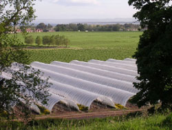
Eashing Farm has also been under the spotlight (April 2009) after a mobile phone operator erected an 85ft (26m) tall mast without planning permission. T Mobile, who erected the mast in 2008, were issued with an enforcement notice in August of that year to remove it from the land which is designated as being of outstanding natural beauty and of special environmental quality. The company, which had to remove an installation from the Godalming water tower after the lease expired in 2007, had appealed but has now been instructed by the planning inspector to remove the mast and an equipment cabinet and generator from the site by July 2009. MORE ABOUT ENVIRONMENTAL DESIGNATIONS High Court Ruling Concludes A ruling from the High Court (December 2006) has brought to a close a long-running dispute between the local council and residents against the extensive use of polytunnels for intensive horticulture at Tuesley Farm (GR: SU964418) near Godalming. Mirroring similar intensive horticulture schemes elsewhere in the Wey Valley and southern England, the 469 acre farm has been at the centre of considerable local opposition since the farm was bought by a major soft fruit supplier in 2003.
The Hall Hunter Partnership, who are a key supplier of soft fruit to Waitrose, in 2004 began to erect 12ft (3.6m) plastic polytunnels on the farm in order to produce strawberries, blackberries and raspberries on an extended growing season of up to 6 months. All the erected polytunnels cover 39 hectares of land. Prior to the development of 'Spanish polytunnels', which first saw the light of day in Britain in 1998, the growing season was restricted to six weeks. They also installed 45 mobile homes and caravans on the farm to house 250 farm workers over the 10 month growing season. Waverley Borough Council issued planning enforcement notices requiring that polytunnel erection was stopped. Divided into three fields of 70, 100 and 250 acres the first soft fruit under the owners was harvested in June 2004. Seventy acres are dedicated to organic fruit. Hall Hunter also operate on farms in Berkshire and nearby Shere, with their produce marketed through Berryworld Ltd. Local villagers were joined by environmental pressure groups including the Campaign to Protect Rural England (CPRE) and Friends of The Earth (FOTE) to condemn the use of chemical sterilizers on the soil and to contest the development on planning permission grounds. In what was described as a landmark decision (December 2005) the Planning Inspector ruled in an enforcement action after an 11 day Public Enquiry that the polytunnels and mobile homes should be removed from the farm which falls within protected Green Belt and an Area of Great Landscape Value (AGLV). This decision upheld enforcement notices previously issued by Waverley Borough Council outlawing the tunnels and accommodation on the grounds that no planning permission had been granted for the structures. The National Farmer's Union are concerned that the decision will set a precedent that will jeopardise one of the few agricultural sectors that are experiencing growth in the UK The owners Hall Hunter had been given a year to comply with the order but they had lodged their appeal which was heard in the High Court in December 2006. They also offered a compromise plan, in order to safeguard their business and the livelihoods of the farm workers and 20 full-time employees, which was presented to a forum hosted by Waverley Borough Council in September. Hall Hunter had offered to rehouse workers within existing farm buildings and to remove the outermost polytunnels which are closest to local domestic dwellings, effectively cutting polytunnel cover by 10%.
Hall Hunter also planned to introduce an education centre to show how the farm is run, restore wetlands and create a community meadow, and to extend the footpath network that runs through the farm.
The local objectors, who had formed a campaign group under the banner of the Tuesley Farm Campaign (TFC), welcomed the proposals but don't feel they went far enough to minimise the impact of the farm's horticultural activity.
WBC Councillor Adam Taylor Smith was clearly unimpressed by the latest Hall Hunter plans.
In the December High Court hearing an argument was put over by Timothy Straker QC for the Hall Hunter Partnership that the polytunnels were erected for crop rotation and therefore could not be legally classed as permanent buildings covered by the 1990 Town and Country Planning Act. However the court ruled in favour of Waverley Borough Council and in what is regarded as landmark ruling stated that farmers need planning permission to erect plastic polytunnels. The ruling has been met with mixed reaction, from elation by the Campaign to Protect Rural England (CPRE) to despair by the National Farmers Union (NFU), and British Summer Fruits (BSF) who represent growers of 92% of UK-produced soft fruit and fear that the ruling could threaten the £200m soft fruit industry in Britain.
The NFU, fearing a backlash countrywide after the ruling has been mediating in clashes over polytunnels between villagers and farmers, has developed a code which asks growers to resist siting polytunnels within 30 metres of a private house. This code will from 1st January 2007 become compulsory for all suppliers of soft fruit to supermarkets.
The use of polytunnels reduces the use of pesticides by 50 per cent. Sources: The Hall Hunter Partnership, who own and manage Tuesley Farm, are planning to mount a final bid to keep the farm operating. The partnership will be submitting a revised planning application and have in the process approached neighbouring parish councils in an attempt to secure local support for the scaled down plans. The new plans have reduced coverage by polytunnels from 50% to 11% of the farm area and that blocks of covered crops would be broken up to make them less visually intrusive. The polytunnels would also not be erected on most of the outer fields. Source: Waverley Borough Council approved (November 2007) the planning application by the farm to erect polytunnels on up to 20 hectares working on a rotational basis within a clearly defined 190 hectares of land. The approval is conditional upon a legal obligation for the farmer "to manage the farm to minimise the impact of polytunnels on the landscape". © Wey River 2005 - 2012 |